Reach-based review
Open media by river reach, visible map extent, path segment, project, or capture date instead of guessing which folder contains the right pass.
River and stopbank inspection
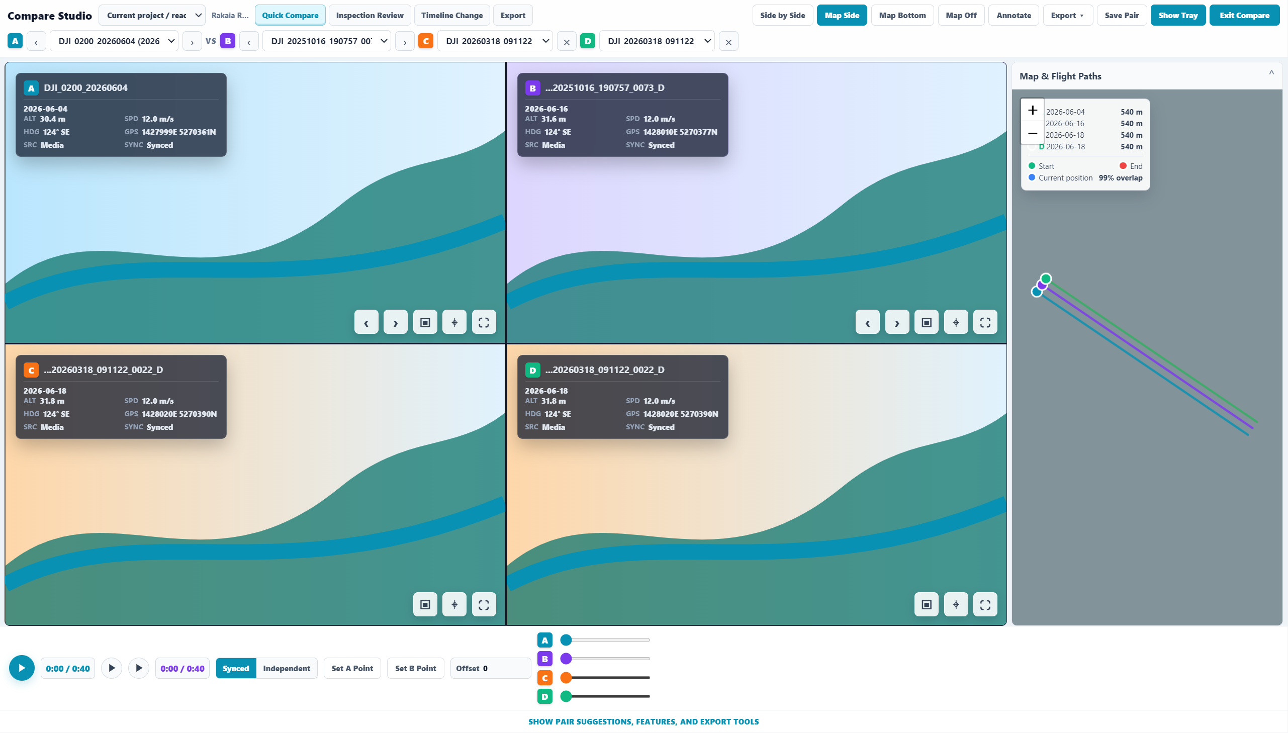
Rivers, stopbanks, seawalls, roads, and corridors generate repeat drone media across long linear assets. Sightlock helps teams index that media by geometry so inspection history can be opened from the map and compared across dates.
Open media by river reach, visible map extent, path segment, project, or capture date instead of guessing which folder contains the right pass.
Compare the same stopbank, seawall, channel, river bend, bridge approach, or coastal section across different flights and different dates.
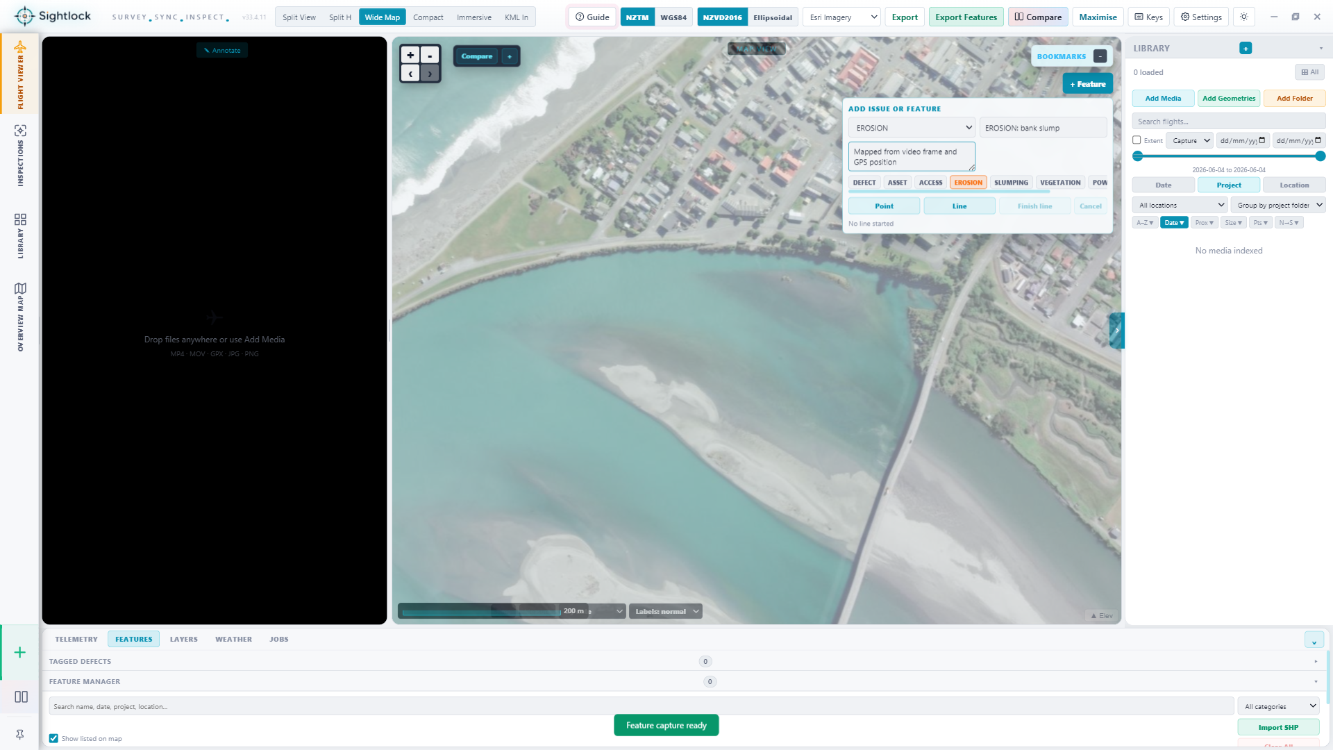
Record erosion, scour, vegetation encroachment, gravel bar change, bank slumping, damage, or other observations while keeping time, geometry, and media context attached.
Teams can keep years of inspection geometry searchable without loading the whole video archive into the viewer each time they need one reach.
Operational fit
Sightlock fits councils, consultants, contractors, and asset owners who need a practical way to revisit footage, compare repeat flights, and export evidence without turning the product into a heavy asset management system.
Free launch access
Index a folder, open the geometry from the map, and test repeat comparison before adding payment information.