What gets indexed
Sightlock stores project folders, media rows, thumbnails, capture dates, source paths, missing-file state, GPS point counts, track length, project extents, telemetry source, and media geometry.
Drone media repository
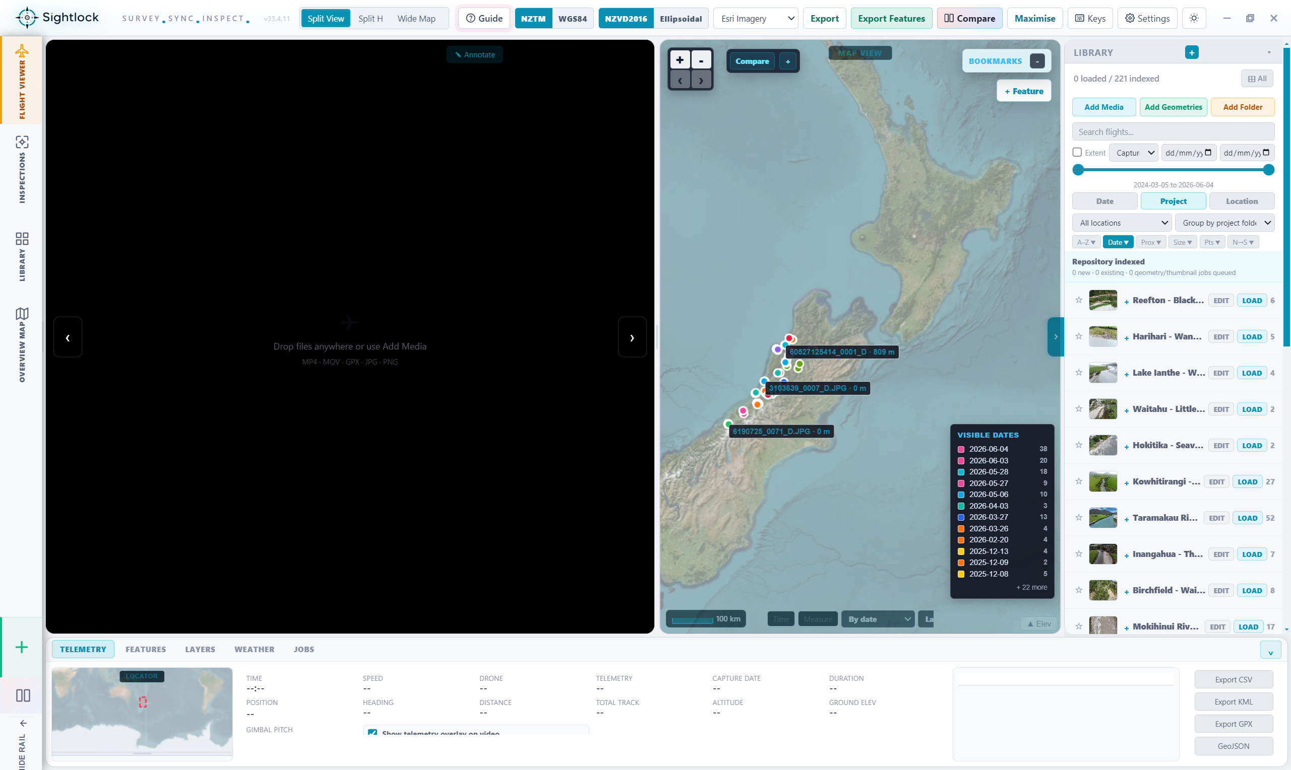
Sightlock is built for organisations with a lot of drone video, photos, telemetry, and inspection evidence. It indexes the archive once, remembers the spatial geometry, and lets teams find media by project, date, location, extent, or flight path.
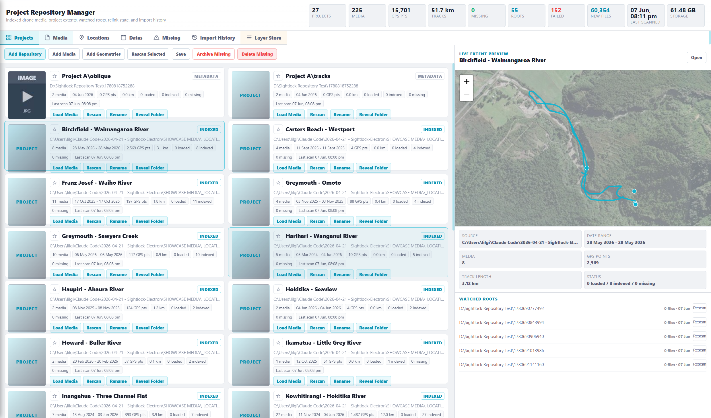
Sightlock stores project folders, media rows, thumbnails, capture dates, source paths, missing-file state, GPS point counts, track length, project extents, telemetry source, and media geometry.
Drone archives become difficult when the only route back to a video is a filename. Sightlock makes the map the primary navigation layer, so a user can click the place they care about and open the related media context.
The repository model avoids loading every raw file at once. Teams can keep indexed geometry, thumbnails, and status live while loading only the media required for the current inspection.
The product direction includes watched roots, scan history, failed files, missing files, new files found, loaded/indexed status, project cards, and live map preview for each project or reach.
Core workflow
Add a repository, let Sightlock index the media geometry, select a project extent or visible map area, open matching media in Flight Viewer, compare repeat inspections, then export features or evidence.
Keep pilot captures, project folders, and repeat flights searchable without relying on memory or manual spreadsheet logs.
Move from media rows to map extents, layer context, imported shapefiles, feature export, and geometry-backed review.
Review rivers, coastlines, stopbanks, roads, corridors, and sites through inspection media that stays tied to location.
Launch access
Start with one account key, index a project, and test whether map-first drone media retrieval fits your team.